
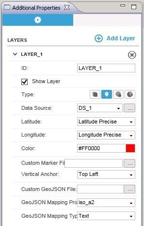
 In the additional properties tab, enter a name for the layer and choose the following appropriately.
1. Type – Marker
2. Data Source
3. Latitude
4. Longitude
5. Color for Marker
By using the mathematical functions in SAP Design studio, the distance is calculated between the two locations. In our example, the distance is calculated between sales offices in two zip codes.
The map below shows the sales offices plotted in various zip codes. When we click on a particular sales office in a zip code, it gets displayed as shown below.

Now, select the end point i.e. the second sales office. When selected, the distance between these two sales offices are shown.
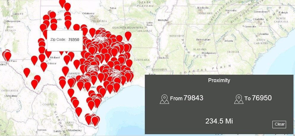
Please note that this calculated distance is the diagonal distance between two sales offices and not the distance on road. This type of analysis can also be used for goods distribution from a warehouse or between warehouses.
For more information, reach out to Visual BI
New NetWeaver Information at SAP.com
Very Helpfull